Itineraries for excursions
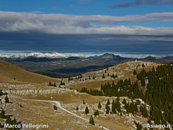
Hiking and walking itineraries: Itinerary - Excursion on the Melette di Foza, Monte Fior
INTRODUCTION TO THE ROUTE FOR THE MELETTES OF FOZA - MONTE FIOR
TheAsiago Plateau Seven Municipalities is definitely one of the most historically relevant places in Italy for the war events that took place there during the First World War. The proposed itinerary here takes the hiker to one of the most spectacular and significant places in the battlefields.
The proposed route is ideal for those who want to discover a path of high historical value and at the same time have the opportunity to admire and learn about the many natural and geological beauties of the area.
ITINERARIO: Melette Excursion - Monte Fior
Technical guidance
Degree of Difficulty: Challenging
Climbing: 740 metres
Min altitude: 1,083m above sea level
Max Altitude: 1,824m above sea level
Length: 10 Km (Round trip)
Walking time: 4/5h (tourist gait)
Means: walking
The hike is considered challenging,walkable by experienced hikers and with sufficient training. The first section of the route, covers most of the altitude of the hike.
It is necessary to be equipped with a flashlight given the two important and evocative passages inside galleries.
HOW TO GET TO THE STARTING POINT
The starting point of the trail is located at the center of the Municipality of Foza at an altitude of 1083 m,where you can park the car, not for a fee. Various bars and a grocery store give you the opportunity to stock up on all the comforts you need for the day trip.
Those who enter the Plateau coming from the'Valdastico Highway (Piovene-Rocchetteexit), to reach Foza, must follow the directions to Asiago by climbing along the SS 349 "State of Cost". Arriving at Asiago must then continue in the direction of Gallio and from here follow the directions to Foza. A fortnight after passing the village of Asiago, you will reach Foza.
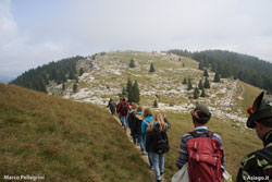
THE PATH TO THE FOZA MELETTES - MONTE FIOR
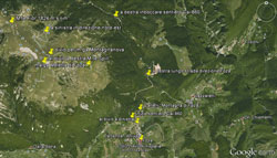
It starts from the center of Foza (Vusche : ancient place cymbro) near the Church St. Mary Assunta (patron celebrated on 15/08). After passing the church, entirely built with exposed blocks of white marble of the place, you follow in a north-wetter direction along the provincial road that leads to Enego for about 600 meters, at the crossroads that leads to Vastagna; in Contrada Cruni you hold the left and climb in the direction" Futa Plain".
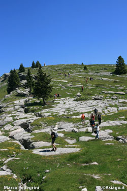
About 200 meters from the last houses you can see on the left two explanatory boards of the paths of the "Mountain of Foza" with topographical and historical-naturalistic-cultural indications. From here we continue along a military mule made during the First World War and indicated by Cai signpost with the number 860.
The trail stretches for about 4 km,allowing you to reach the 1824 m above the top of Mount Fior. The 740 m difference is made less challenging by thehairpin bend,which greatly reduces the slope of the walk.
THE POINT OF ARRIVAL: MOUNT FIOR
After about an hour of completely shaded path,and therefore can be carried out even on the sunniest days, you arrive at the edge of the forest near Foza's Melette Malga.
Leaving the farm behind, continue on the access road to the same in a northerly direction.
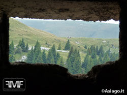
Arriving at the top of Mount Meletta you are at a crossroads, from which you continue straight for a hundred meters in the direction of Malga Montagnanova and then, abandoning the road to the right, you climb along the sweet slope of Mount Spill that in 10 minutes will lead us to the highest point of the territory of Foza and our itinerary: Mount Fior (1824 m.s.l.m), an exceptional panoramic point with a complete view. To the west you can admire the Highland conca with gauge in the foreground Gallio,then Asiago, Camporovere, Canove,plus a magnificent overview of the entire high area, Portule, Cima Larici, Cima XI and XII, Ortigara, Calidiera. To the north stands Castelgomberto and in the background the group of Brenta and the Lagoraichain.
 Throughout the area you can see the remains and traces of the war event that between 1915 and 1918,
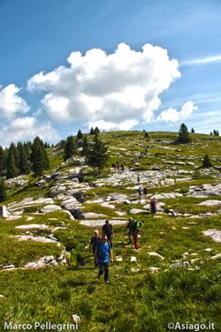 it shocked our countries and mountains, now recovered and included in the project "Ecomuseo of the Prealps Vicentine – The Places of War and Literature". Fifty meters from the summit point of Mount Fior,in the summer months you can find a telescope to better enjoy the surrounding scenery.
On Mount Castelgomberto a monument dedicated to the heroic General Euclid Turba, gold medal for Military Valor.
General Turba was a teacher of military art at the Academy of the Guard of Finance in Caserta. He died on Mount Castelgomberto during the First World War while taking his side of the Perugia Brigade to the front line. Today he rests in the Military Sacrament of Asiago.
After visiting the whole area up to Castelgomberto you descend in the direction of Malga Lora and proceed downhill along the dirt road until you cross the Cai 860 trail that will easily lead us to the starting point.
All rights reserved. We accept no responsibility in the event of damage to persons and things that occurred along this route.