Itineraries for excursions

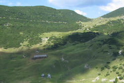
Malga Portule and Meatta Dorsal
Route Basa Senocio's Crossroads in Monte Meatta and Bocchetta Portule with return to the Portule valley, Meatta ridge - Asiago Plateau
INTRODUCTION TO THE ITINERARY
The starting point of the itinerary can be reached by car from Asiago in the direction of Trento. Past Camporovere and the Val d'Assa, continue on the provincial road for about five kilometres, reaching the area of thedirt road that branches to the right in the direction of Galmarara (indicator sign not clearly visible). You take this road that goes up to half-coast on the south side of the Val Scaletta until you reach the valley floor again at the crossroads of Basa Senocio. Here you can leave cars at the side of the road, being careful not to block the transit to agricultural, forestry or rescue vehicles that may need, and rightly have the right, to go beyond the bans.
ITINERARY: Basa Senocio's crossroads - Mount Meatta and Bocchetta Portule
Technical guidance
Degree of difficulty: medium (only in absolute absence of snow)
Difference: 850m
Altitude-min: 1,150m above sea level
Altitude-max: 1,937m above sea level
Length: 13 km (round trip)
Walking time: 6/7 hours
Means: walking
THE ASCENT ROUTE TO MOUNT MEATTA AND TO MOUTH PORTULE
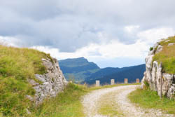
Abandoned the Galmararacarriage, which from here climbs with steep hairpin bends on the right, you pass the bed of the stream - almost always dry - following for a hundred meters the road of valley floor that you then leave to take to the left, climbing the forest road on the right orographic side of the Portule Valley until reaching the former Casara Meatta (1445 m). From here you continue for a short stretch along the wooded road that soon becomes a military mule and at a crossroads that you meet just beyond you take to the left climbing with regular slope a series of hairpin bends through the steep slope of the Ribalta,always remaining immediately under the ridge - thus deflecting from the Austro-Hungarian shot coming for the first year of the Great War from the positions of Vezzena.
Continuing the ascent you pass immediately east of the summit of Mount Meatta (1897 m), accessible by a short digression off the trail, until you reach theHerah of Orsara (1890 m). "The Hague" was once defined as the horizontal pitch on which the"poiatte"were built, that is, the piles of timber covered with leaves and earth that served for the production of charcoal. From this point we continue following in a slight descent the mule track that, carved into the slope, passes upstream of a vertical rock band allowing a transit always in full safety given its width; however, the latter section is to be tackled only in the absence of snow,since the slope above is prone to avalanche detachment.

Archduke Eugene Road
When you reach the Austrian military road of Archduke Eugene (1864 m), you go up to the left, West, touching a fountain and then quickly reaching Bocchetta Portule (1937 m) with its gunners:this is at the highest point of the route and looking out at the mouth you have a splendid glance on the Larches,the Val Formica,on the border ridge from Cima Mandri to Spitz Vezzena and on the eponymous plain.
RETURN TO PORTULE VALLEY
In relation to the climatic conditions, the lunch break can be carried out in the area equipped near the gunboats or going back along the road ofArchduke Eugene reaching the intersection called The Monuments,for the tombstones raised here by the VI Division J'ger, then descending to the immediately below Malga Portule (1713 m), equipped with a local room always open.
The return to the vehicles will take place following the entire route of the now abandoned mule track of the Portule Valley that starts at the watering hole located on the valley floor just below the Malga.

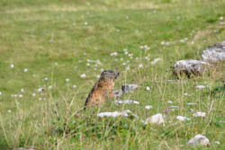
Marmot
It descends to the center of the valley for about half a kilometer; here, due to a narrowing with a series of impractical rock jumps, you abandon the valley floor taking the track that continues slightly downhill on the left side of orographic, East.
Once you've gone over the top of mottolo, you'll always touch the ruins of Casara Portule di Sotto (1500 m) and, after crossing on a bridle built of stone the valley floor taking to the right side orographic you take the forest road in very bad condition that with a couple of hairpin bends descends to the bivou of Casara Basa Senocio (1254 m).
From here in a short time, on the forest road, we will return to the Bivio and the cars of the same name, closing the route.
PHOTO GALLERY OF THE ROUTE FROM BASA SENOCIO CROSSROADS TO MONTE MEATTA AND MOUTH PORTULE
All rights reserved. We accept no responsibility in the event of damage to persons and things that occurred along this route.