Itineraries for excursions
 Itinerary for orienteering Val Formica - Dossi, Asiago plateau
HOW TO GET TO THE STARTING POINT
From the center of Asiago continue to Camporovere and Vezzena. You will find on the right the road with the signs to reach the locality Val Formica: the information panel of the fixed orienteering system near the refuge. (Coordinate: Gauss Boaga spindle West ROME 1940 5.093.828 N, 1.686.421 E; GMS UTM WGS 45° 58' 20,9229''N, 11° 24' 21,4883''E).
ORIENTEERING ITINERARY: Val Formica - Dossi
Technical indications
Degree of difficulty: E - Hiking
Difference in altitude: 151 m
Min elevation: 1688 m asl
Max altitude: 1811 m asl
Length: 4264 m (Round trip)
Walking time: about 1h 30 minutes (tourist pace)
Means: on foot
Instrumentation: Map, Compass, GPS
ITINERARY DESCRIPTION
In the open-air gym that surrounds us there are the "fixed" points of the path that are made with white-orange signs to be reached and the relative identification code. The map becomes a detailed tool for reading the territory to be explored with the use of the territory through recreational activities every day with themed itineraries and places to visit.
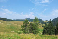
In Val Formica, a well-known ski area, we are in the middle of a basin with large pastures surrounded by coniferous woods that become more suggestive on the tops of the mountains.
It starts from the plain of the Val Formica Refuge (altitude 1695 m above sea level.m.) and crosses a mountain environment of the malga pastures.
We visit the points of the recommended itinerary in the order indicated using the map and compass or the GPS with the recommended tracks and coordinates. On the top of the bumps opens on the horizon the view of Cima Larici, Portule and Monte Verena to get lost in the distance towards the plain of Vezzena.
The forest crossed, where the capercaillie lives, is formed by spruce, white fir and larch and begins to make room for mountain pine and dwarf juniper. The forest is periodically cut to leave room for renewal and sell the timber obtained. Chamois and roe deer, are frequent inhabitants of these areas, as well as the sighting of marmots, with their burrow near the paths. A nice detail: marmots are so accustomed to the presence of man that they no longer whistle to signal the danger.
The itinerary will take us in view of the houses of the area, Laste di Manazzo, Dosso di Sotto much sought after by the Malghesi for the quality of its pastures and for the breadth of the views: from the nearby Piana di Vezzena, to the north walls of Monte Verena, to the long ridge of Cima Portule to the east. Casara Porta Manazzo is not far from the saddle of Porta Manazzo overlooking the Val di Sella; crossing very productive pastures rich in flora and history.

SEQUENCE OF POINTS TO VISIT
|
|
Code |
Description |
Coordinate Gauss Boaga West Spindle (ROME 1940) |
GMS UTM coordinate (WGS 84) |
| 1 |
31 |
Bivio carareccie |
No 5,093,339, E1,686,597 |
N45° 58' 04,9204'', E11° 24' 28,9732'' |
| 2 |
32 |
Traversable fenceCrossable fence |
No 5,093,409, E1,686,319 |
N45° 58' 07,4584'', E11° 24' 16,1653'' |
| 3 |
33 |
Vegetation limit, East corner |
No 5,093,361, E1,685,792 |
N45° 58' 06,4189'', E11° 23' 51,6321'' |
| 4 |
38 |
Hole with vegetation |
No 5,093,843, E1,685,781 |
N45° 58' 22,0334'', E11° 23' 51,7951'' |
| 5 |
43 |
Isolated tree |
No 5,094,408, E1,685,829 |
N45° 58' 40,2773'', E11° 23' 54,8137'' |
| 6 |
|
Finish |
No 5,093,828, E1,686,421 |
N45° 58' 20,9229'', E11° 24' 21,4883'' |
GPS POINTS
Download the file to reach the individual points by clicking here: GPS points Val Formica - Dossi
GPS TRACK
Download the file to follow the recommended route and reach the control points indicated by clicking here: GPS track Val Formica - Dossi
MAP
You can download the map for the excursion with the location of the control points suggested with the itinerary by clicking MAP VAL FORMICA - DOSSI. You will also find reported additional points to visit independently.
© Asiago.it REPRODUCTION RESERVED.
All rights reserved. We accept no responsibility in the event of damage to persons and things that occurred along this route.