Itineraries for orienteering on the Asiago Plateau
Itineraries for excursions
Itineraries for orienteering on the Asiago Plateau

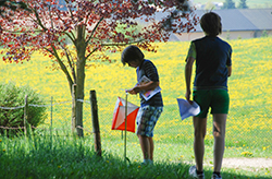
Orienteering is a sport that is practiced in the open air, in constant contact with nature, making use of maps, compasses and GPS. The goal of an orienteering path is to reach control points called "lanterns" (white-orange) according to a precise sequence of points marked on a topographic map
This sport can be practiced by walking, running, skiing or cycling. In addition to refining the logic of orientation, this "natural" sport allows you to discover the beauties of the territory on which it is practiced.
The Asiago Plateau with its woods is particularly suitable for fun: there are in fact permanent fixed orienteering paths that allow the practice of orienteering to everyone with educational and amateur purposes.
We have prepared for you themed itineraries accompanied by maps to practice orienteering on the Asiago Plateau. The recommended itinerary allows everyone to take a walk, or a run, passing by the points shown on an easy-to-read map. The points themselves can also be reached with the use of GPS by the hiker.
Here is the list of some recommended itineraries in the Asiago Plateau 7 Municipalities with their references.
Discover also the Itineraries for excursions and walks, the Itineraries for Ebike and Mountain Bike and the itineraries of taste.
All rights reserved.