Itineraries for excursions
 Itinerary for orienteering Prunno - Lazzaretto, Asiago plateau
HOW TO GET TO THE STARTING POINT
From the center of Asiago continue towards Bassano and pass the hospital of Asiago. You will find on the left the road to reach the locality Prunno di Asiago. (Coordinate: Gauss Boaga Fuso Ovest ROME 1940 5.081.395N, 1.686.296E; GMS UTM WGS 84 45° 51' 28,5528''N, 11° 31' 41,6280''E).
ORIENTEERING ITINERARY: Prunno - Lazaretto
Technical indications
Degree of difficulty: E- Hiking
Difference in altitude: 117 m
Min elevation: 1069 m asl
Max altitude: 1133 m asl
Length: 3151 m (Round trip)
Walking time: about 1h (tourist pace)
Means: on foot
Instrumentation: Map, Compass, GPS
ITINERARY DESCRIPTION
With map and compass it is possible to explore the territory that surrounds us with recreational activities every day through themed itineraries and places to visit. In the open-air gym of the Asiago Plateau 7 Municipalities there are the "fixed" control points that are made with white-orange signals and the relative identification code.
If you are wondering where the toponym "Prunno" comes from, there is a brief introduction to be made first. The Asiago Plateau, or rather the population that inhabits it, derives largely from the ancient people of the Cimbri, or the Native German-speaking people who settled on our mountains hundreds of years ago. "Prunno" therefore derives from the Cimbrian "Prun" which in turn originates from the native German speaker "Brunn", or source / fountain. An ancient spring was recovered by the manager of the hut, Edoardo Leoni, intrigued by the type of aquatic vegetation that grew in the surrounding area.
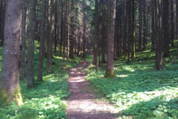
Leaving behind the depression of the locality Prunno di Asiago (altitude 1069 m above sea level.m.) we pass under the provincial road and head into the Woods of Barenthal along the ancient communication routes now simple forest roads.
You cross large areas with traces of the First World War (trenches, tunnels). Taking the dirt road that enters the woods it is difficult to imagine how this land, now covered by lush spruce forests, was upset by bloody battles and incessant bombing during the First World War. We visit the points of the recommended itinerary in the order indicated using the map and compass or the GPS with the recommended tracks and coordinates.
The forest crossed is formed by spruce and white fir and is periodically cut to leave room for renewal and sell the timber obtained. The roads followed lead to Turcio, to Mount Corno with the English cemetery of Barental and the church of San Sisto in Lazzaretto, a stopping point of the Great Rogation. On the way back the same provincial road is crossed along a bridge used during the winter for cross-country trails.

SEQUENCE OF POINTS TO VISIT
|
|
Code |
Description |
Coordinate Gauss Boaga West Spindle (ROME 1940) |
GMS UTM coordinate (WGS 84) |
| 1 |
36 |
Small depression |
No 5,080,815, E1,696,410 |
N45° 51' 09,6610'', E11° 31' 46,0576'' |
| 2 |
37 |
Hillock |
No 5,080,709, E1,696,211 |
N45° 51' 06,4338'', E11° 31' 36,6836'' |
| 3 |
49 |
Forest edge |
No 5,080,959, E1,695,873 |
N45° 51' 14,8727'', E11° 31' 21,3924'' |
| 4 |
45 |
Depression |
No 5,081,143, E1,695,802 |
N45° 51' 20,9015'', E11° 31' 18,3726'' |
| 5 |
34 |
Crossroads |
No 5,081,556, E1,695,864 |
N45° 51' 34,2071'', E11° 31' 21,8498'' |
| 6 |
|
Finish |
No 5,081,395, E1,696,296 |
N45° 51' 28,5528'', E11° 31' 41,6280'' |
GPS POINTS
Download the file to reach the individual points by clicking here: gps points Prunno - Lazzaretto
GPS TRACK
Download the file to follow the recommended route and reach the control points indicated by clicking here: GPS track prunno - Lazzaretto
MAP
You can download the map for the excursion with the location of the control points suggested with the itinerary by clicking on MAP PRUNNO LAZZARETTO. You will also find reported additional points to visit independently.
© Asiago.it REPRODUCTION RESERVED.
All rights reserved. We accept no responsibility in the event of damage to persons and things that occurred along this route.