Itineraries for excursions
 Itinerary for orienteering Campolongo - Campovecchio - Asiago plateau
HOW TO GET TO THE STARTING POINT
From Mezzaselva continue towards Monte Verena. You will find on the left the indication for the Piana di Campolongo with the information panel of the fixed orienteering system. (Coordinate: Gauss Boaga fuso Ovest ROME 1940 5.085.469 N, 1.685.647 E; GMS UTM WGS 45° 53' 51,0701''N, 11° 23' 33,8999''E).
ORIENTEERING ITINERARY: Campolongo - Campovecchio
Technical indications
Degree of difficulty: E- Hiking
Difference in altitude: 146 m
Min elevation: 1588 m asl
Max altitude: 1660 m asl
Length: 4286 m (Round trip)
Walking time: about 1h 30 minutes (tourist pace)
Means: on foot
Instrumentation: Map, Compass, GPS
ITINERARY DESCRIPTION
One of the oldest tools for reading and exploring the territory is undoubtedly the map which, together with the compass, is a cornerstone of recreational activities with themed itineraries and natural places to visit and explore. To help each other in the "open-air gym", there are "fixed" control points, made with clearly visible white-orange signals and bearing the relative identification code.
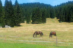
It starts from the plain of the Campolongo refuge (altitude 1601 m above sea level.m.) and crosses the typical mountain environment of the malga pastures. We visit the points of the recommended itinerary in the order indicated using the map and compass or the GPS with the recommended tracks and coordinates.
The forest crossed is formed by spruce and white fir and is periodically cut to leave room for renewal and sell the timber obtained.
The pastures of Campolongo have been associated for years with those of Campovecchio. The former modernized malga is the seat and starting point of an important cross-country skiing center with both competitive and amateur tracks that reach the nearby Trentino.
The itinerary will take us to visit the two farmhouses in the area, namely Campolongo and Campovecchio (still in business) overlooking the nearby Monte Verena. You cross pastures rich in flora and wrecks of the pastoral activity of previous centuries. Campovecchio develops along the road that leads to the ski resorts of Monte Verena, at about 2000m above sea level. All around, the spruce woods are the ideal habitat of the urugallo - also praised by Rigoni Stern - and not far away you can hear the continuous roar of the grouse.

SEQUENCE OF POINTS TO VISIT
|
|
Code |
Description |
Coordinate Gauss Boaga West Spindle (ROME 1940) |
GMS UTM coordinate (WGS 84) |
| 1 |
32 |
Isolated tree |
No 5,085,818, E1,685,729 |
N45° 54' 02,2888'', E11° 23' 38,1877'' |
| 2 |
43 |
Isolated tree |
No 5,086,195, E1,686,078 |
N45° 54' 14,1540'', E11° 23' 54,8962'' |
| 3 |
44 |
Fencing |
No 5,086,745, E1,685,902 |
N45° 54' 32,1307'', E11° 23' 47,5015'' |
| 4 |
46 |
Ruin |
No 5,086,701, E1,686,216 |
N45° 54' 30,4005'', E11° 24' 02,0019'' |
| 5 |
47 |
Carareccia curve |
No 5.085.925, E1.686235 |
N45° 54' 05,2603'', E11° 24' 01,7996'' |
| 6 |
40 |
Glade |
No 5,085,756, E1,868,035 |
N45° 53' 59,9840'', E11° 23' 52,2901'' |
| 7 |
41 |
Rock |
No 5,085,318, E1,686,112 |
N45° 53' 45,7295'', E11° 23' 55,2495'' |
| 8 |
|
Finish |
No 5,085,469, E1,685,647 |
N45° 53' 51,0701'', E11° 23' 33,8999'' |
GPS POINTS
Download the file to reach the individual points by clicking here: gps points Campolongo - Campovecchio
GPS TRACK
Download the file to follow the recommended itinerary and reach the control points indicated by clicking here: gps track Campolongo - Campovecchio
MAP
You can download the map for the excursion with the location of the control points suggested with the itinerary by clicking on MAP CAMPOLONGO - CAMPOVECCHIO. You will also find reported additional points to visit independently.
© Asiago.it REPRODUCTION RESERVED.
All rights reserved. We accept no responsibility in the event of damage to persons and things that occurred along this route.