Itineraries for excursions
 Itinerary for orienteering Rotzo - Castelletto, Asiago plateau
HOW TO GET TO THE STARTING POINT
From the center of Rotzo continue and pass the cemetery. You will find on the right the information panel of the fixed orienteering facility near the football field. (Coordinates: Gauss Boaga Fuso Ovest ROME 1940 5.081.506N, 1.686.246E; Coordinate GMS UTM WGS 84 45° 51' 42,1912'N, 11° 23' 56,1469''E)
ORIENTEERING ITINERARY: Rotzo - Castelletto - Italy
Technical indications
Degree of difficulty: T - Tourist
Difference in altitude: 87 m
Min elevation: 909 m asl
Max altitude: 978 m asl
Length: 3598 m (Round trip)
Walking time: about 1h (tourist pace)
Means: on foot
Instrumentation: Map, Compass, GPS
ITINERARY DESCRIPTION
With the map we have a very detailed tool for reading the surrounding landscape to be used for the exploration of the territory as an everyday recreational-recreational activity with themed itineraries and places to visit. In the open-air gym there are the "fixed" points of the path identified by white-orange signs and the relative identification code.
Starting from the information panel near the football field (altitude 967 m above sea level.m.) we head inside the Rotzo countryside along the ancient communication routes now serving potato crops. You cross large areas cleared and cultivated over the centuries with characteristic dry stone walls and heaps of boulders that scatter the plain of Rotzo dotted with groves.
We visit the points of the recommended itinerary in the order indicated using the map and compass or the GPS with the recommended tracks and coordinates. The forest crossed is formed by spruce and deciduous trees such as willows, alders.
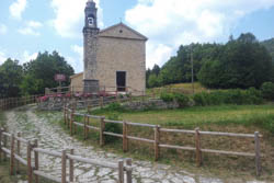
The paths that we invite you to travel, lead you to touch cultural emergencies such as the ancient church of Santa Margherita, the first monument sign of Christianity on the Plateau of the 7 Municipalities. The building is located as a construction around 1100 and is located right in the center of the most "historical" territory of the Plateau: between the Bostel - place of the first human settlement - and the Altarknotto - Sacrificial area dedicated to the pagan gods with the nearby top of the Altaburg.
To date, there are not many documents relating to the origin of the church of Santa Margherita. Its history, in fact, is only partially collected in the oral tradition handed down also in official documents, so much so that in the report of the episcopal visit of 1602 it is recorded that "this was the first church of the Seven Municipalities".
The nearby places overlooking the Val d'Assa, where pastoralism was once practiced and in small spaces also agriculture with a breathtaking view of the Pasubio and Monte Cimone with Tonezza. On the way back from the countryside you cross the village of Rotzo to return to the starting point.

SEQUENCE OF POINTS TO VISIT
|
|
Code |
Description |
Coordinate Gauss Boaga West Spindle (ROME 1940) |
GMS UTM coordinate (WGS 84) |
| 1 |
32 |
Bivio carareccia |
No 5,081,199, E1,686,271 |
N45° 51' 32,2282'', E11° 23' 56,8776'' |
| 2 |
37 |
Capital, South-West corner |
No 5,081,137, E1,685,888 |
N45° 51' 30,5935'', E11° 23' 39,0455'' |
| 3 |
38 |
Rock |
No 5,080,618, E1,685,814 |
N45° 51' 13,8634'', E11° 23' 34,8957'' |
| 4 |
39 |
Trail junction |
No 5,080,687, E1,685,546 |
N45° 51' 16,3571'', E11° 23' 22,5750'' |
| 5 |
34 |
Bivio carareccia |
No 5,081,017, E1,685,523 |
N45° 51' 27,0628'', E11° 23' 21,9672'' |
| 6 |
35 |
Road junction |
No 5,081,376, E1,685,415 |
N45° 51' 38,7897'', E11° 23' 17,4611'' |
| 7 |
36 |
Street corner |
No 5,081,466, E1,685,871 |
N45° 51' 41,2609'', E11° 23' 38,7152'' |
| 8 |
|
Finish |
No 5,081,506, E1,686,246 |
N45° 51' 42,1912', E11° 23' 56,1469'' |
GPS POINTS
Download the file to reach the individual points by clicking here: GPS points Rotzo - Castelletto
GPS TRACK
Download the file to follow the recommended route and reach the indicated control points by clicking here: GPS track Rotzo - Castelletto
MAP
You can download the map for the excursion with the location of the control points suggested with the itinerary by clicking on MAP ROTZO CASTELLETTO. You will also find reported additional points to visit independently.
© Asiago.it REPRODUCTION RESERVED.
All rights reserved. We accept no responsibility in the event of damage to persons and things that occurred along this route.