Itineraries for excursions
 Hiking and walking itineraries: Excursion in Val D'Assa
INTRODUCTION TO THE VAL D'ASSA ROUTE
TheAsiago Plateau has a wide variety of environments of the highest natural value and historical and cultural significance.
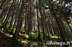
The proposed itinerary takes us to the discovery of the Val D'Assa and allows us to visit a place that will touch many of these aspects, starting from the naturalistic one, with an intact and very characteristic environment, to the historical one through the visit of some sites occupied by the Austro-Hungarian army during the First World War to the prehistoric one with the opportunity to visit the famous rock carvings.
ITINERARY: Val D'Assa
Technical guidance
Degree of difficulty: easy
Difference:200m
Min altitude:791m
Maximum altitude:994m
Length: Full lap about 11 km, returning from the Ambrosini 6 km
Walking time: 6 hours full lap, 3 hours with tourist gait returning from the Ambrosini
Means:on foot
This excursion is considered easy to travel,doable even by non-experiencedhikers, particularly suitable during the hot summer days,where you can better appreciate the cool atmosphere that reigns in the valley floor.
HOW TO GET TO THE STARTING POINT OF THE ROUTE
For those arriving from Asiago the starting point of the route is located at the bridge on State 349 a couple of kilometers after the village of Canove,from where starts a forest road that follows the orographic right of the Ghelpach valley. For those arriving from Vicenza the junction is about 2 km after Treschè Conca in the direction of Canove. The quarries in the immediate vicinity will allow us to easily identify the location.

THE PATH
The first 2 km of the route winds along the forest road that runs through the entire Ghelpach valley. Along this first stretch of route, there are already some particularly striking places, such as the "Shaff Kugela" ("shepherd's shelter") a rocky ledge that completely overtakes the road. With a small detour from the main road (only for experienced hikers) you can also visit the "Leute Kubala" ("people's cave") a large natural cavity also known as the "mati cieseta", where tradition says the inhabitants of Canove took refuge during the destruction of the country in 1487.
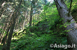
After this first stretch the road begins to veer eastwards and descend along the hydrographic left of the Val D'Assa gradually turning into a path. As you descend to the valley floor you perceive a sharp increase in environmental humidity that has a long-going impact on the development of vegetation,here as much as ever varies.
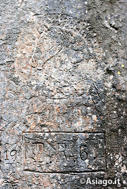
Along this stretch of trail are the first signs left by the passage of man in completely different eras. Here, in fact, next tothe iron-age engravings called romita you can observe, carved in the rock, also an equine head that probably indicates the stationing of Hungarian soldiers (Ussari) during the First World War.

The trail continues along the valley for a couple of kilometers, before reaching a crossroads where we can choose to end our walk up the valley of San Antonle and rejoining the highway in Ambrosiniresorts, or to continue descending to the bottom of the Val D'Assa.
The advice is to continue the journey through the deepest valley of the Plateau, as in an hour's walk you can reach the most famous site of rock carvings named of the Tunkelbald, surely worthy of a visit.
The return can then be made by going up the forest road that emerges at the cemetery of Canove. From here it is advisable to return through the resorts Busi and Holla (walking the mule that follows the small valley where the Bassestock liftswere located ) thus avoiding the traffic and confusion of the highway.
The site of the Tunkelbalt (graffiti)in Valdassa is accessible only by guided tour: at 9:00 on Tuesday from Roana (church area) and on Saturdays at 9:00 from Canove (church area) or on request specific to groups. The licensed cooperative for the graffiti guided tour is Archeidos of Rotzo. The ride in Valdassa without graffiti, on the other hand, is doable independently.
All rights reserved. We accept no responsibility in the event of damage to persons and things that occurred along this route.