Itineraries for excursions
 Itineraries for excursions and walks: From Malga Larici to Porta Renzola
FEATURES OF THE TRAIL
The stretch from the Malga to the entrance of the path with no movement to the Portule is well placed and shows the cobbled still intact, as is typical of the Austrian military mule drivers; from the ban to the CAI crossing, the bottom is in excellent condition; the trail to Porta Renzola is very steep, full of stones, roots and excavated in some places by the weather.
ITINERARIO: Malga Larici
Technical guidance
Degree of Difficulty:
from the farmhouse to the crossing Cai: easy
from the Cai crossing to Porta Renzola:very challenging
Climbing: 324 metres
Min altitude: 1,625m above sea level
Max Altitude: 1,949m above sea level
Length: 11.6 Km (Round trip)
Walking time: about 3h (tourist gait)
Means: walking
HOW TO GET TO THE STARTING POINT
From the intersection of the Millepini Park (located at the entrance to Asiago) you take the provincial 349 to Trento; you walk 12 km and the sign that marks: 50 km, on the right you will find and follow the signs x Larici and Portule. The road is all paved and in good condition. The dirt boat starts only at the right intersection towards Malga Larici below, at the beginning of the hike.
DESCRIPTION OF THE ITINERARY FROM MALGA LARICI TO PORTA RENZOLA
Leaving the farm on the right, you begin to climb along the dirt road, with the still obvious imprint of the perfect Austrian road engineering: the stone edges and the stone bottom covered with a stone. After 3 hairpin bends, you reach the attack of the path to the Portule, where there is a transit ban.
After this signal, a good stretch of trail is flat, then climbs slightly into the semi-curve with overstrada the shepherds' shed (placed at mt.1768) to unroll in falseplan to the intersection towards Porta Renzola, well indicated by the sign CAI white/red - trail 826.
So far so good, it is "a walk",as they say, but from here on out things change, because the path is also tight 20/30 cm between the grassy banks and in some places very steep: more suitable for goats than humans! But it's still safe for transit. The CAI table indicates 25 minutes to reach the goal, but it is a lack of optimism, because with a tourist gait - which requires a few breaks to catch your breath - it takes almost an hour. This is the continuation of the CAI 826 trail to the Portule and, given that it is a shortcut to portule top, only taken from behind, keeps the same identification number.
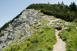
But let's start from the crossroads: immediately the ascent gets steep and begins to meander between spruce roots, white, larch and mugo profusion. In some places the roots are the steps, in a fascinating intril that manages to hold back the ground on which the foot rests. Many boulders serve as a barrier but also as a containment and the mugo, diligently cut and signaled by the CAI in picturesque places, also fulfills the task of holding the bottom. You go up, you go up and only a few large trees, they grant a cooling break from the solle. Signs of CAI (white/red) and military mule (yellow) everywhere: impossible to go wrong!
A few tracts in the false plateau slows down the breath, but on the other hand exposes to the rays of the sun... Raising your eyes you can finally see the line between earth and sky: Porta Renzola is close! Two meters below it is signaled a CAI deviation for the Larches, which is ignored, since the Gate is now there. It could only be called the place: a gateway to Trentino, to the Alps, which indomitable stand out endlessly in front of the eye. The site was a junction point for Austrian ziplines for supplies of food, weapons, soldiers, during World War I. The base untath untathed: almost a monument to memory. "Not to forget..."

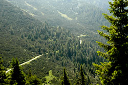
The descent, after an obligatory break, is less strenuous, but equally challenging: you have to be careful where you put your feet! Never as in this case it is mandatory to be equipped with sticks and hiking boots with a good grip,as well as drinks and sugars, especially if the walker comes directly from the plain, with a difference of almost 2000 meters to climb and as many to return. The descent allows you to have a perfect view of the beautiful path that leads to Bocchetta Portule, the Val Renzola, the majestic Verena in front, until you catch a glimpse of the provincial for Trento and even Malga Pusterle down below. The horizon just in front, above Val Formica, is dotted with cows at the pasture and the profile of other huts: a fascinating sight!
Take the main trail 826 to "Malga Larici below", thus returning to be "a walk",almost a stretching exercise for the tired muscles of the legs, to be put now only "under the table" of the audience of the farm.
Beppa Rigoni Scit
Some photos taken from the itinerary from Malga Larici to Porta Renzola
All rights reserved. We accept no responsibility in the event of damage to persons and things that occurred along this route.