Itineraries for excursions

Panoramic
Val Magnaboschi excursion route - Monte Zovetto
INTRODUCTION TO THE ITINERARY
ITINERARY: Val Magnaboschi - Mount Zovetto
Technical guidance
Degree of difficulty: easy
Difference: 150m
Altitude-min: 1,087m above sea level
Maximum altitude:1,232m above sea level
Length: 3.6 km (round trip)
Walking time: 2 hours
Means: walking
The whole area that we will visit with this walk is famous for the events that happened here during the First World War,and in particular for having been occupied, starting in March 1918,by the British troops. In 1918, British soldiers were involved in the defence of much of the territories of the western part of theAsiago Plateau,particularly during the Austro-Hungarian offensive of 15 June 1918.
It is precisely to the Allied army, sent to Italy since November 1917,that part of the fortification of the area, actually already occupied by the Italian army. The area still bears the signs of that tragic period, with a complex line of hyper-fortified trenches occupying the scenic summit area of Mount Zovetto.
HOW TO GET TO THE STARTING POINT OF THE ROUTE
Shortly after the village of Treschè Conca arriving from Vicenza or passing the village of Canove for those arriving from Asiago,you will find the signs for Cesuna (fraction of the Municipality of Roana). Right in the center of the village we will have to turn left following the directions to the Kubelek Refuge and after a few kilometers we will reach a crossroads, where, at the Chapel of St. Anthony is located the starting point of our route.

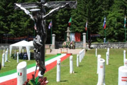
Val Magnaboschi Italian Cemetery
THE ROUTE FROM VAL MAGNABOSCHI TO MONTE ZOVETTO
Already a few hundred meters from the beginning of our walk we will meet the 2 cemeteries of val Magnaboschi. One of these is an English cemetery (still run directly by the Commonwealth War Graves Commission)where the remains of 183 dead are contained. On the opposite side of the mule, there is the Italo-Austrian cemetery (named "spruce hubs") where fir trunks were used to replace tombstones. In the vicinity of the cemetery there is also a Roman column placed to symbolize the Austro-Hungarian point of maximum advance during the Strafexpedition in 1915.
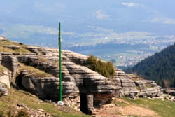
After passing the cemeteries our path continues through a path that crosses a mixed forest of Beech, White Spruce and Spruce (Abieti-Piceo-Faggeta), which facing an uphill stretch will take us to the above area of Mount Zovetto. Once we have finished walking through the stretch in the woods we will intercept the paved road at a hairpin bend. Here we will take a dirt road that will take us back to walk another stretch in the woods before making room for the summit clearing of Mount Zovetto. In this area there is a complex system of trenches, armored posts and shelters,now easily accessible thanks to the excellent renovations carried out recently.
At this point we can walk across the fortified line walking some sections within the fortifications and armored machine gun positions. Taking care, along the way you can also find some inscriptions in English left by soldiers at the front in 1918.

Fortification on Mt.
THE POINT OF ARRIVAL: MOUNT ZOVETTO
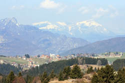
The route will end by reaching the Kubelek Refuge,located on the top of Mount Zovetto where we can observe the stump in memory of the Liguria Brigade that here resisted the Austro-Hungarian attacks during the Strafexpedition in 1916. From this point you also enjoy an enviable panorama of the entire Plateau,from which you can identify as in a huge plastic, all the main peaks of the Seven Municipalities.
On the way back you can follow the main road that descending from the Kubelek Refuge will take us after about half an hour of walk to reach the starting point again.
VAL MAGNABOSCHI ROUTE GALLERY PHOTO - MONTE ZOVETTO
All rights reserved. We accept no responsibility in the event of damage to persons and things that occurred along this route.