Itineraries for excursions
 Hiking and walking itineraries: Asiago route to Mount Ortigara
INTRODUCTION TO THE ROUTE FOR MOUNT ORTIGARA
The itinerary leads to the discovery of one of the most famous places for the rich history of the Asiago Plateau Seven Municipalities.
Of different difficulties,it is suitable for visitors who want to spend a day immersed in the history of the Alps during the First World War. The interest is historical for the events of the First World War,of the naturalistic type for the typical lunar environment of the mountain and finally of the wildlife and floristic for the presence of protected and particular animals and vegetation.
ITINERARIO: Hike on Mount Ortigara
Technical guidance
Degree of Difficulty: Medium
Difference: 350 meters
Min altitude:1,771 m above sea level
Max Altitude: 2,105m above sea level
Length: 7 km (return)
Walking time: 4h (tourist gait)
Means: walking
HOW TO GET TO THE STARTING POINT
Starting by car from the forecourt of Asiago'sice stadium, we proceed on the SP 76 in the direction of Gallio. Once in Gallio, past the center you follow the directions to the resort Melette-Campomulo.
Continuing along the main road for about 6.5 km, you reach and pass the Campomulo hut on the left and proceed for 1.5 km towards the Campomuletto hut; from here the road begins to be dirt,so we advise you to proceed carefully according to the conditions of the road and the vehicle you are using. Continue straight, keeping the main roadway for 7.5 km until you reach the junction that leads to Piazzale Lozze (you follow the yellow sign with the word Monte Ortigara),the default destination for the start of the excursion.
The estimated time from Asiago to Mount Ortigara is 45 minutes.
THE ROUTE TO MOUNT ORTIGARA
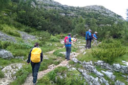
The walking route starts from Piazzale Lozze and proceeds along the CAI's 840 path at an altitude of 1771 m. Proceeding to the mule line located south of Cima della Campanella and Monte Lozze,until reaching the Church of the Lozze. This section climbs into beautiful forest mixed with fir trees (Picea excelsa), larches (Larix deciduous) and begins to notice the mugo pine (Pinus mugo).
Walking along the main mule, you reach 1906 m, reaching the church of lozze, built by the alpines of the Verona battalion after the battle of June 1917. Here you can also visit an Ossuary,containing the human remains still available on the battlefield today. Above the church, there is the postwar shelter in honor of Lieutenant Giovanni Cecchin,gold medal for military value.

After passing the church it is advisable to proceed inside the trench,arranged thanks to the work of theEcomuseus of the Great War and visit the observatory of Colonel Brigadier Jacopo Cornaro, located on Mount Lozze. At an altitude of 1920 m, Mount Lozze enjoys a strategic vantage point to understand the vast battlefield of ortigara.
The trail from here follows the trail of the tricolor flag to the small Ortigara Hut,construction that offers shelter to those who are nearby in case of bad weather.

THE POINT OF ARRIVAL: MOUNT ORTIGARA
Leaving the Bay behind, we proceed west,passing along the Coston dei Ponari,the attack route used by the alpines in June 1917. Climbing up you get to the Austro-Hungarian trench excavated inside the rock and part of the works that are called " MecenseffyWorks " named after Commander Artur Von Mecenseffy. Along this stretch of path, the limestone rock is marked by a few patch of mugo pine. Those who are luckier also have the chance to come across an alpine star,which alone, tries to survive the collection of those who too beautiful do not respect it.
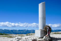
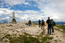
 Shortly thereafter we reach the top of the mountain at an altitude of 2105 m where in 1920 the National Alpine Association emits the column mozza in memory of the tragic events of 1916-1917,where the famous inscription "not to forget"appears. After leaving the Italian stump we proceed to the north and after a few minutes you will descend to the 2086 m altitude where the Austrian stump is erected. From here the trail gets more dangerous and a note of attention should be placed,especially if the path is wet. Precisely because of the danger, ropes have been placed to help the descent.
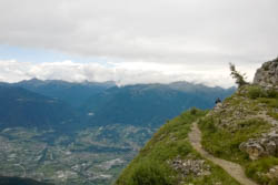
Halfway through you enter a tunnel, acave post named after Colonel Biancardi,commander of the Queen Brigade and eventually you get to the Agnella Pass. From here you follow the path to the south inside the Lambse Wall. The view is spectacular, above our head to the right Mount Ortigara and to the left the Cima della Caldiera,another important mountain in June 1917. After passing the small cemetery you return to the Ortigara Baito and from here along the same tricolor road towards the Church of Lozze and the Piazzale Lozze.
VIDEO OF THE HIKE ON MOUNT ORTIGARA
GALLERY PHOTO OF THE ROUTE TO MOUNT ORTIGARA
All rights reserved. We accept no responsibility in the event of damage to persons and things that occurred along this route.