Itineraries for excursions
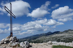
Cross of Cima Caldiera
Itinerary to Cima Caldiera
INTRODUCTION TO THE ITINERARY FOR CIMA CALDIERA
The itinerary leads to the discovery of one of the places sadly among the most famous for the war events that took place during the great war on the Asiago Plateau Seven Municipalities.
The interest is therefore historical but also naturalistic, faunal, floristic for the presence of protected and particular animals and vegetation as well as landscape. The views in fact range from Verena to Melette in Marcesina, from Valsugana to Lagorai, up to the nearest peaks: Ortigara, Dieci, Dodici, Portule.
ITINERARY: Excursion to Cima Caldiera
Technical indications
Degree of Difficulty: Medium
Difference in altitude: 354 meters
Min altitude: 1.771m asl
Max Altitude: 2.124m asl
Length: 7 Km (round trip)
Walking time: 3,5 h (tourist pace)
Means: on foot
HOW TO GET TO THE STARTING POINT
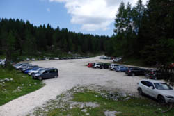
Piazzale Lozze: starting point
From the center of Gallium follow the signs for Melette-Campomulo. Continuing along the main road for about 6.5 km, just before the Campomulo refuge you proceed keeping the road on the right for 1.5 km towards the Campomuletto refuge / Sentiero del Silenzio. From here the road turns white: proceed with great caution. Continue straight on, always maintaining the main roadway for about 3.5 km where the road returns to be paved until you reach Piazzale Lozze, where a large parking lot allows you to leave your car and start the excursion. In case of doubt, follow the signs for Piazzale Lozze/Monte Ortigara. From Gallio, Piazzale Lozze can be reached by car in about 40 minutes.
THE PATH TO CIMA CALDIERA
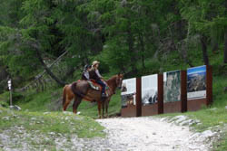
The route to Cima Caldiera
From Piazzale Lozze (1771 m) from the area where there are the explanatory panels of the Ecomuseum of the Great War, follow the path n ° 840 of the CAI towards Chiesetta del Lozze. The forest road passes through a beautiful mixed forest of fir trees (Picea excelsa), larch (Larix decidua) and the mountain pine (Pinus mugo) begins to be noticed.
After about 900m (25 min) you reach an altitude of 1906 m, reaching the Church of Lozze, built by the Alpini of the Verona battalion after the battle of June 1917. Here you can also visit an Ossuary, containing the human remains still available on the battlefield. Above the church, there is the refuge built in the post-war period in honor of Lieutenant Giovanni Cecchin, gold medal for military valor.
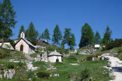
The Church of Lozze (1906m)
Then continue the path following the yellow signs for cima Caldiera (keep right towards CAI path 841): you then pass in an area recently arranged thanks to the works of the Ecomuseum of the Great War where there are trenches. At an altitude of 1920 m of Monte Lozze you can enjoy a strategic panoramic point to understand the vast battlefield of Ortigara.
After about 15 minutes of walking you reach a crossroads: on the left you go towards "Pozzo della Scala", while on the right, where we turn you go towards path 841 and, above all, Cima Caldiera. After a narrowing, keep to the left where you will see six tunnels under the eastern slopes of the mountain. During the Great War they served as warehouses and, connected by an internal corridor between them, were one of the main centers of storage of food, ammunition and materials necessary for combat. This point can also be reached directly from Piazzale Lozze in about 40 minutes following the path n. 841.
The summit is still about 35 minutes away, but they will pass very quickly: the road continues north and climbs gently along the Caldiera. After a hairpin bend of the road to the left you quickly climb up to a saddle (1958 m) that leads into the trench located just below the top. From here the view is already noteworthy.
THE ARRIVAL POINT: CIMA CALDIERA
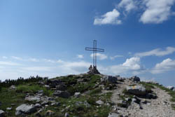
Arrival point: Cima Caldiera
Once here, the ascent to the summit in a further 5 minutes deserves a last effort. Reached the cross placed at an altitude of 2124 m the horizon opens to 360 ° and a thought to those who have lost their lives in these places is a must.
THE RETURN
To return you can take the path back so far made and in the final stretch follow the CAI 841 path instead of passing through the Church of Lozze. Otherwise you can descend to the west on a more challenging path that descends quickly through trenches and walkways until you reach Pozzo della Scala (2004 m). From here you can easily reach Baito Ortigara in 10 minutes of walking from which in a further 20 minutes of walking you reach Chiesetta Lozze to return to the starting point: Piazzale Lozze.
For the more experienced from Baito Ortigara you can extend the itinerary by walking towards Mount Ortigara (35 minutes) along the second part of the excursion described here: Itinerary for Mount Ortigara.
VARIANT
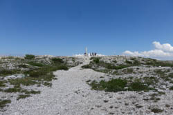
Mozza Column of Mount Ortigara
From Monte Ortigara you can go towards the top of Dieci (or Monte Castelnuovo) along the high road of the highlands. To return to Piazzale Lozze in this case it is advisable to pass near the Campigoletti Cemetery then to go down the Val Agnella and, turning left for Busa Fonda di Moline at an altitude of 1800m, reach the starting point of the excursion. In the latter case, the excursion will record a positive difference in height of 750m and a total development of 13.5 kM.
© Asiago.it REPRODUCTION RESERVED. IN COLLABORATION WITH ALBERTO MAZZOCCO & ILARIA GIOVANNINI
THE VIDEO OF THE EXCURSION TO CIMA CALDIERA
PHOTO GALLERY OF THE HISTORICAL ITINERARY FOR CIMA CALDIERA WITH VARIANT FOR MOUNT ORTIGARA
All rights reserved. We accept no responsibility in the event of damage to persons and things that occurred along this route.