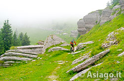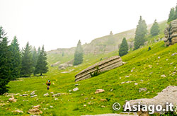
Spectacular rock formations of Mount Fior
Itinerary For Mountain Bike (MTB) Asiago - Valbella - Valle Dei Ronchi - Monte Fior (the City of Rock)
Itinerary For Mountain Bike (MTB) on Monte Fior: one of the most beautiful places on the plateau to visit, with its original and spectacular rock formations located on the top. This morphological feature makes it called the city of rock. Do not underestimate the historical significance of this mountain, the scene of numerous fights during the First World War. As evidence of this, at the top, there is a path along the trenches with tables that tell the story of these places during the war period.
ITINERARY (MTB): Asiago - Valbella - Valle Dei Ronchi - Monte Fior (the City of Rock)
Technical indications
Length: 53 Km
Difference in altitude: 1400 mt.
Maximum height: 1796 mt
Difficulties: DEMANDING
Walking time: 4 hours
HOW TO GET TO THE STARTING POINT
Leaving the Palazzetto del Ghiaccio, take via Trento-Trieste in the direction of the town center. At the second roundabout, turn right into Via Matteotti and then, after a hundred meters, turn left into Viale della Vittoria.
The road leads right in front of the military shrine of Asiago: symbol of the province of Vicenza and place where the bones of thousands of fallen of the First World War rest. The shrine can be visited free of charge, bearing in mind that it is not possible to enter the avenue with the Mountain Bike.
ITINERARY DESCRIPTION
The itinerary continues along a dirt road in false plane that passes through fields, located to the left of the shrine. After about 700 meters, turn right for a grassy cart track, not very visible, which going up through a meadow at the center of which there is a large tree. After passing the tree, the road to Zocchi will appear more visible and, after crossing some houses, you will have to turn left on a paved road. At the end of a descent of 150 meters, turn into the dirt road of via Tilman, initially downhill but then going up.

The Stona di Sopra district and the hairpin bends that reach it
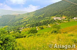
Be careful not to take a side road but follow the road that, in its final stretch, enters a small valley between two rises, increasing in slope, until you cross the asphalt in Bertigo. Turn left at the next intersection and follow the signs for the Valbella ski lifts. After passing the lifts, follow the road that becomes unpaved and climbs towards Malga Stenfle. From the hut, you can enjoy a beautiful view of the plateau: Stand out among others Asiago and Gallium, the latter you can also admire the Pakstall ski jump, unused for several years.
From the hut, go down to the left for the dirt road that, after a few hundred meters, goes into a forest. The dirt road is in good condition in the first section, while in the second, especially in correspondence with the crossing of a small stream, the bottom is very bumpy until it becomes almost a stony ground.
After this downhill stretch you arrive at a bridge. Cross the bridge and immediately after turn right. The road continues to descend along the valley called Valle dei Ronchi, crossing picnic areas until you reach the Gianesini district where the asphalt meets. Turn left and climb for 300 meters until you cross another road. Keep right at the intersection and continue in the direction of a bridge that for its size makes it look almost like a viaduct. Arrived near the bridge, take the dirt road on the left and continue along the valley for 2 km until you reach the Cnotenar district.
Here keep to the right leaving out the road that goes up and continue along the dirt road until you meet the Tessar di Sotto district. At this point the road becomes paved and climbs in a straight way. After about 800 meters, turn right towards the Stona di Sotto district.

City of Rock: one of a kind
Near this district the road climbs with a sequence of 10 close hairpin bends. Even if the slope is a bit accentuated, the asphalt surface allows you to climb with your Mountain Bike (MTB) without particular difficulty, until you cross the main road that connects Gallio to Foza. Cross the road, turn right and continue along the main road to the center of Foza, reached after 1 km.
Once in Foza, continue the main road that passes next to the church to the Lazzaretti district. At the contrada, leave the main road and turn left. The road begins to climb with two hairpin bends spaced between them and arrives, after 3.5 km, near Malga Fratte. Turn left and take the dirt road towards Roccolo Rinaldo - Monte Zomo.
At a crossroads, turn right towards Bocchetta Lora and then Malga Lora, 3 km from the junction. This stretch, and especially the next one from the hut to the top of Monte Fior, are challenging riding the Mountain Bike, due to the slope and the bottom not always in good condition.
The effort, however, is rewarded because, after Malga Lora, you begin to glimpse near the top the trenches that have undergone restoration work in recent years. Along the last stretch of the climb you can admire all the surrounding peaks also seeing some Dolomite peaks.
For those who want to take it easy, the advice is to abandon the MTB near the sign indicating the path to the top of the mountain (10 min) and to go to see the trenches, as well as to read all the indications prepared along the way from the Ecomuseum of the Great War, where the various events of the period are told, taken from publications; one of them is the book entitled "Un anno sull'Altipiano" by Emilio Lussu.

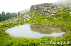
Puddle of Biasia
Back to the Mountain Bike (MTB), the road begins to descend towards casera Montagna Nova. From here begins a beautiful single track that leads to cross the natural beauty of the place: the famous rock city. On the right of the route, you can see truly unique sedimentary rock formations.
Paying attention to the path, not always of excellent cycling, you descend gently through a small puddle-pond until you meet a junction where you will turn left towards Malga Slapeur. The first meters after the junction force you to bring the MTB by hand but immediately after, as soon as a meadow begins, the path becomes a cycle path and leads, after a few hundred meters, to the aforementioned malga.
From the hut, resume the dirt road that descends with a couple of close hairpin bends and then take on a up-and-down trend. Leave out the lateral ones that meet, and follow the main course of the road that runs around the circumnavigation of the mountain, home in the winter period of the ski lifts of the Melette area. At a certain point the road enters the trenches with two rock walls on the sides and after this short stretch, you get to take a hairpin bend. Keep left and walk a climb of 500 meters, you get to a hill.
From here starts a descent that leads, after about 1 km, to a junction with a paved road. Turn left and get off at Rifugio Campomulo. From here, in order not to make the itinerary too demanding, the end of the route develops following the paved road that descends through Gallium and then Asiago, the starting point of the itinerary.
In collaboration with Altopianobike
ROUTE MAP
PHOTO GALLERY OF THE ASIAGO ITINERARY - VALBELLA - VALLE DEI RONCHI - MONTE FIOR (THE CITY OF ROCK)
All rights reserved. We accept no responsibility in the event of damage to persons and things that occurred along this route.