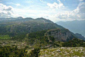
The top of nearby Mount Ortigara
Itinerary for Mountain Bike (MTB) Asiago – Scoglio Bianco – Cima Caldiera – Val Galmarara
This route is the most difficult variant to reach the top of Mount Caldiera. It is a very demanding itinerary that, in the central part, forces you to disassemble from the bike and continue on foot for several stretches. The effort is rewarded by the wild environments crossed, culminating with the arrival at the top of Mount Caldiera with a 360-degree panorama.
ITINERARY (MTB): Asiago – Scoglio Bianco – cima Caldiera – val Galmarara
Technical indications
Length: 57 Km
Difference in altitude: 1890 mt.
Maximum height: 2096 mt
Difficulty: difficult
Walking time: 6 hours
ITINERARY DESCRIPTION
Starting from the Ice Stadium of Asiago head towards the airport and walk along part of the perimeter of the air surface and then take the road that leads to Mount Zebio.
The road initially paved becomes unpaved and develops following the course of the nearby Val di Nos.
Always go straight leaving out respectively the junction towards Malga Zebio and the junction towards Casera Zingarella.
Arrived at an intersection in the Casera Busette area continue straight starting a very technical climb from the bumpy bottom that will culminate near a junction where you will turn left.
After another short and challenging climb, the forest gives way to a wide esplanade where the mountain pastures of Malga Fiaretta open.
In the distance you can already see to the north-east the top of the Caldiera main destination of the itinerary.
Be careful to follow the cart track (trail 850), which then becomes a jagged path of stones and rocks, reach Malga Fiara.
At Malga Fiara follow the signs for Malga Mandrielle, reached after about 2km of false plan and then towards Malga Fossetta after a further 4.5km.
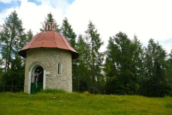
From the hut climb the dirt road towards the church of Fossetta located a few hundred meters from the hut.

The Fossetta Church
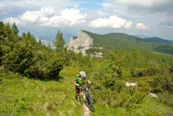
From here starts the most challenging stretch of the route made up of numerous walking passages that will lead first to Porta Incudine and then to the junction located about 100 meters from the top of Mount Caldiera.
Attention: this stretch in addition to being steep and bumpy in some places, is about 4km long, mostly traveled with the bike by hand or on the shoulder, so you need a certain physical preparation and spirit of adventure.
The path, at the end, reconnects to the mule track that leads to Cima Caldiera on top of which is placed a metal cross with an Italian flag.
Here too you can admire a fantastic panorama with the surrounding peaks, first of all that of the nearby Monte Ortigara, with its severed column, a symbol of the First World War.
From the top the descent on a mule track towards Piazzale delle Lozze is very simple compared to the route taken previously.
The next stages of the itinerary are the Moline Refuge, useful for a short refreshing break and, subsequently, the area of Piazza delle Saline.
Once you reach this junction, turn right towards Monte Forno and the Conrad junction.
At the Conrad junction the view opens towards the Val Galmarara where a long descent begins that passes through the homonymous malga and continues towards Malga Galmararetta.
After this last hut continue for 1.3km until you reach a fork where you have to keep to the left leaving out the main road.

Challenging trail to the top
Pay attention because this bifurcation is not very visible and you risk skipping it especially because the descent invites you to let go of the bike.
At the fork, the road resumes climbing with short challenging stretches to the Mosciag cemetery.
Past the cemetery continue along the main road towards the Interrupted Fort. Here begins the descent towards Asiago, which becomes paved in the second part.
In order not to risk descending towards Camporovere, pay attention to a left turn towards a stony cart track that leads to the San Domenico district fraction located at the gates of the center of Asiago.
In collaboration with Altopianobike.
ROUTE MAP
PHOTO GALLERY OF THE ASIAGO ITINERARY – SCOGLIO BIANCO – CIMA CALDIERA – VAL GALMARARA
All rights reserved. We accept no responsibility in the event of damage to persons and things that occurred along this route.