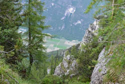
Glimpse of Valsugana
Itinerary for Mountain Bike (MTB) Campomulo – Barricata – Castelloni di San Marco
The Castelloni di San Marco, in the Asiago Plateau, are a natural rock formation that takes on the appearance of a labyrinth. This natural phenomenon deserves to be visited because it is unique in its kind.
The itinerary is very challenging to do by bike, especially in the last part (about 600 meters) where you have to carry the bike by hand or on your shoulders. The descent to Malga Fossetta (optional) is suitable for experienced bikers.
ITINERARY (MTB): Campomulo – Barricata – Castelloni di San Marco
Technical indications
Length: 29 Km
Difference in altitude: 990 mt.
Maximum height: 1803 mt
Difficulty: medium (difficult if you choose the descent to Malga Fossetta)
Walking time: 4 hours
ITINERARY DESCRIPTION
It starts from Campomulo, reachable from the village of Gallium by taking the road to the Ski Lifts of Melette.
The Campomulo area is famous for being, in winter, home to the Nordic ski lifts in the area.
From the starting point go north towards Campomuletto and Malga Fiara. Near Malga Fiara keep right going towards Malga Mandrielle.
Beyond the area of the hut there is a junction that will lead, downhill, towards the Piana di Marcesina.
Here the road is mainly downhill and reaches after about 4.5 km the Barricata Refuge. From the refuge take the asphalt downhill towards Grigno and pay attention after 1 km to the dirt road that comes off on the left.
From here starts the road that goes up for 5 km to the Castelloni di San Marco. At the junctions that meet along the road keep to the left. At a certain point the road ends and, as mentioned in the introduction, the last 600 meters will be covered with the bike by hand or on the shoulder to the entrance of the labyrinth where, compulsorily, it will be necessary to leave the bike and start the visit on foot.
After the visit you have 2 alternatives: go down the road or head right towards Malga Fossetta.

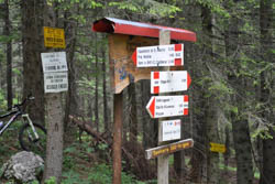
Signage in the route
This part is very technical and suitable for experienced bikers. The bottom is steep and jagged with rocks and in several places you will need to get off the bike.
When the challenging stretch ends you will arrive at an esplanade near Malga Fossetta.
After the hut you meet the dirt road downhill that leads back to Malga Mandrielle, Malga Fiara, Campomuletto and Campomulo, places crossed on the way out.
ROUTE MAP
PHOTO GALLERY OF THE ITINERARY CAMPOMULO – BARRICATA – CASTELLONI DI SAN MARCO
All rights reserved. We accept no responsibility in the event of damage to persons and things that occurred along this route.