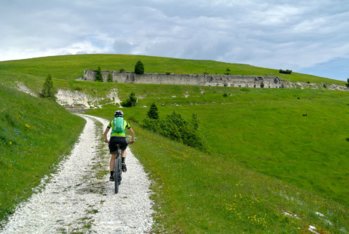
Barracks before the top of the Lisser
Itinerary for Mountain Bike (MTB) Campomulo – Marcesina – Monte Lisser – Rifugio Barricata
Route that leads to the top of Mount Lisser and its homonymous fort. The route runs both outward and return the Piana di Marcesina home in the winter period of the cross-country trails of the area.
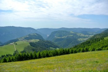
Splendid the view that can be enjoyed from the top of the mountain!
ITINERARY (MTB): Campomulo – Marcesina – Monte Lisser – Rifugio Barricata
Technical indications
Length: 39 Km
Difference in altitude: 990 mt.
Maximum height: 1630 mt
Difficulty: medium
Walking time: 3.5 hours
ITINERARY DESCRIPTION
The starting point of the itinerary is Campomulo reachable from Gallio in about 15 minutes from the road that leads to the Melette ski lifts.
From Campomulo go up towards Campomuletto and, at the first junction, turn right.
The road climbs for a few hundred meters and then begins the descent towards the Piana di Marcesina.
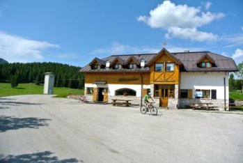
Continue following the descent, leaving out the junctions that you meet, until you reach the area of the Marcesina Refuge (not to be confused with the Hotel Marcesina).
After the refuge continue on asphalt towards Rifugio Val Maron, leaving it after about 2 km, to take a dirt road on the right that will lead to Casera Palma.

In the distance the village of Foza
From the casera starts the last stretch of climb that leads to the top of the Lisser with its fort, still under renovation.
The top of the mountain is worth a break because it offers a 360-degree panorama towards the Plateau, the Valsugana and the nearby Dolomites.
After the break, the descent takes place along the ski slope of the lifts that are located after bypassing the perimeter of the fort.
Looking towards the valley, keep to the left of the ski lift and take the slope diagonally down to the Chalet Val Maron.
From the Chalet take the paved road passing through the Val Maron Refuge reached after a few hundred meters and point towards the Forcellona pass that will lead to climb again towards the Piana di Marcesina.

The Marcesina refuge
At the point of the hill, take the path to the right that descends sideways until you meet, after the last stretch of wood, the road that leads to Malga Val Coperta.
Once you reach the hut, continue towards the Barricata Refuge, a place recommended for a lunch break.
After the refuge climb for about twenty meters to a house / hut belonging to the Municipality of Grigno.
Cross the courtyard of the structure and cut through the lawn until you meet a dirt road (not very visible) that leads first to Malga Fiara, then Campomuletto and Campomulo.
In collaboration with Altopianobike.
ROUTE MAP
PHOTO GALLERY OF THE MTB ITINERARY CAMPOMULO - MARCESINA - LISSER - RIFUGIO BARRICATA
All rights reserved. We accept no responsibility in the event of damage to persons and things that occurred along this route.