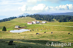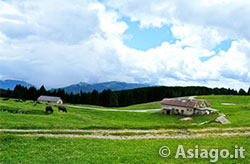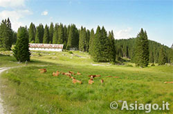
Meadows and pastures in the Posellaro alpine area
Mountain Bike Route (MTB) Roana – Mandrielle – Posellaro Trugole
This is a pleasant mountain bike (MTB) route, cross the forest in false plane in the first part (great for hot summer days), and then climb towards the area of the huts, some of which offer the opportunity to buy typical local products. The itinerary does not have particularly demanding points, except for the dirt stretch of about 3 km that climbs up to Malga Mandrielle.
ITINERARY (MTB): Roana – Mandrielle – Posellaro Trugole
Technical indications
Length: 31 Km
Difference in altitude: 800 mt.
Maximum height: 1575 mt
Difficulties: AVERAGE
Walking time: 3 hours
HOW TO GET TO THE STARTING POINT
The start of the itinerary is at the lake of Roana. Of note is the possibility to sunbathe in the seaside area of the lake or try the experience of the acropark with its 8 paths that wind through cable cars and walkways.
ITINERARY DESCRIPTION
Once you arrive at the pond take the road uphill to the left. The route climbs for about 3 km with slopes not too marked, until you meet a road that paves on the right closed by a metal bar. Take the road and follow it for about 6 km. This stretch is very pleasant as it runs on a slight slope through the Val d'Assa, crossed by the homonymous stream that is almost always dry as the karst terrain typical of the area allows water to penetrate the subsoil.
Along the valley you can admire: on the right the Cima del Portule and the area of Cima Larici, while on your left, even if not visible, on the North-East face of Monte Verena. Arrived at a crossroads, keep left and climb, with slopes never extreme, for about 3 km until you climb near Malga Mandrielle, where a panorama opens up towards the surrounding mountains.

Malga Mandrielle
Cross the paved road that in winter is home to the cross-country trails of Campolongo and turn right. The road climbs slightly for a few hundred meters and then descends again. Attention: at the second hairpin bend, leave the asphalt turning left in the direction of Malga Campo Posellaro.
Once at the hut continue along the path, leaving the hut on the right and crossing the meadow / pasture. Be careful as the track is not clearly visible and may be a bit muddy due to the continuous trampling of grazing cattle. Looking at the bottom of the lawn you can see the dirt road to take.
At the beginning of the dirt road you may come across barriers and / or wires to delimit the grazing border of cattle: pay attention and close them again after crossing them.
Continuing the dirt road you arrive at Malga Trugole where, after a slight descent, you climb towards the Crosaron junction and, keeping to the right, you arrive at the Campolongo Refuge, the winter home of the start of the cross-country trails.

Trugole Farmhouse
From the refuge starts the paved road that leads to a junction where you can turn right. Attention: start the descent for about 500 meters , because you will find on the left a junction for a dirt road that after 1 km leads to the Spiazzo dei Mercanti.
In this area, adjacent to Monte Erio, keep left at the intersection, in the direction of Malga Gruppach. Continue downhill to a junction at the Martin bend. From here, go down 100 meters crossing the road traveled on the way to the pond.
In collaboration with Altopianobike
ROUTE MAP
PHOTO GALLERY OF THE ROANA – MANDRIELLE – POSELLARO TRUGOLE ITINERARY
All rights reserved. We accept no responsibility in the event of damage to persons and things that occurred along this route.