Itineraries for excursions

Cima Portule
Itinerary excursion: Alpine Larch-Renzola Port Junction – Cima Kempel-Cima Portule – Alpine Larch Portule-Nozzle Fork
INTRODUCTION TO THE ROUTE
The Portule or Pòrtel in Cimbro or German Kempel, is a Ridgeof the Northern Plateau, visible from most of the Asiaghese basin.
As in many parts of theAsiago plateau 7 communities even this area has unfortunately been theatre of the great war. The ring route that we propose to pass on places where war Theater were built roads, logistics centers, aqueducts, cable-cars, some of them still visible today.
It is an excursion of particular historical relevance and landscaping where doesn't lack naturalistic appearance.
The excursion (route CAI oncoming 826) was listed by Medium difficulty as most of the route from the top species on it is easy. Needs attention and is certainly not to be underestimated for the slope and some exposed stretches between Porta Renzola and Porta Kempel.
ROUTE: Itinerary for each tour: Bivio di Malga Larici-Door Renzola – Top Kempel-Cima Portule – Alpine Larch Portule-Nozzle Fork
Technical indications
Degree of difficulty: medium
Difference in altitude: 697 m
Height-min: 1,611 m above sea level
Altitude-max: 2,308 m above sea level
Length: 14 km (roundtrip)
Walking time: 5.10 hours
Means of transport: on foot
HOW TO REACH THE STARTING POINT OF THE ROUTE
From Asiago along the road leading to Camporovere di Roana and then continue along the SS349 in direction Passo Vezzena/Trento for 10 kM. Half bent at a right turn right and take the road leading to the Locality Larches/Val Ant and follow along some bends to 5.9 kM. This leads to the Alpine Larch Junction (1611 M)
ROUTE DESCRIPTION
Parked the car near the Alpine Larch Junction (some parking spaces at street side) or just ahead near Malga larch Under turning right, you begin the hike.
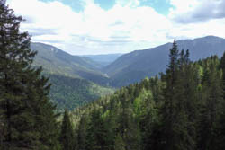
From the junction , follow the dirt road and after just 300 metres you reach Malga larch trees below. Continuing the journey for another 500 metres and exceeding three bends from the reduced slope and the floor well established, you get to ban (1655 M) from which we must rigorously continue on foot or by mountain bike. Easy walk (25/30 minutes) is the stretch from here to 1900 meters accompanies us, winding into a path made of soft curves and straights, to an altitude of 1781 M in località Val Renzola. You walk among firs and larches can be admired on the right next to the majestic Portule and sometimes on the right in the distance, Asiago.

Panoramic view
You can then choose to continue the path directly towards Bocchetta Portule (itinerary for Nozzle Portule) or, as we suggest, address for the most challenging turning sharply left onto the trail CAI 826 leading to Renzola Port. The trail is narrow and steep at times challenging. The flora as standing up becomes less dense and thus leaves room for even better views. Quickly climb to altitude and rifiatando from time to time you can reach the 1949 metres above sea Renzola port from where you can admire the Valsugana, the Val di Sella, the Lagorai and theAsiago plateau on the other.
You can learn more about this first part of the journey by reading the itinerary from Malga Larches at port Renzola by clicking here: route from Malga Larches at port Renzola
Caught his breath and admired the scenery you can resume the hike going up in an easterly direction along the trail CAI 826, for 1.2 kM, towards Porta Kempel/Monte Kempel. The slope is rather steep and sometimes exposed but the scenery that gradually becomes wider repays the effort. The vegetation is scarce ever more towards the top: climb the Mountain Pines disappear.
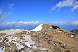
Arrived at the indication Monte Kempel (2295 m) as the rise of the day is done. Following the signs for Nozzle Portule you get to the peak, the highest point of the route to 2308 meters, then, a little further on, on the Cross.
The 360° view, weather permitting, is guaranteed and allows to range widely from Veneto to those mountains of Trentino.

Cableway Austrian Gallery
The path after a well-deserved break to admire the beauties of the places continues towards Bocchetta Portule trail located on the Ridge towards the Filon first, then along the Velocity of Portule until you begin to decline more sharply along the Monte Colombaretta of Portule. At this stage the share decreases gradually but over the karst landscape aspects are observed and the numerous sinkholes that appear next to the path. Return to natural environment even the pines among which the trail always closer to Vent Portule, space.

Erzherog Eugen Strasse
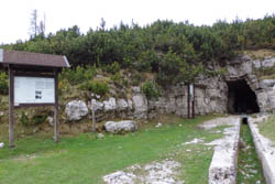
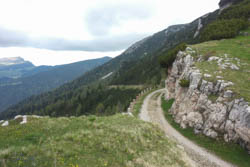
NET is a curve to the right to take us to 1937 m altitude Nozzle Portule where the trail comes out on Erzherzog Eugen Strasse, dirt road that will lead us to Malga larches. It is definitely a must, however, stop to visit the Cave of the guns with a cistern location. Right between the massif of Portule and mount Mahesh — Nozzle Portule, there were "important war in 1916 and played a crucial role in organizing logistics for the entire second half of 1916 Austrian and all 1917." So as you read from the Eco-Museum of the great war, "explanatory panels in 1916° side of the nozzle was made a battery in cave for pieces from 120 mm (entrusted then chapter Marco Guidelli) responsible for blocking the road of Val d Assa. […] the shot of his pieces was not particularly effective and the battery fell then in Austrian hands on 23 August when men of 26° Schutzen occupied Cima Portule and came then to the saddle. […] Once occupied by the Austrians, the saddle was equipped with a magnificent Street dedicated to Prince ruthenium (Prinz Eugen Strasse) and crossed by two cable cars (cars). The gallery that had provided shelter and chambers of combat Italian pieces became the seat of the tanks (80 thousand litres) of water pumped from the bottom of the Val d Assa and intended to quench the troops located throughout the northeastern part of the plateau. From there he passed most of the traffic of the supplies intended for the impressive Field logistics base hen. "
The return of about 6 kilometers is fairly easy on white road well beaten made of soft curves in alternating gentle descent in certain stretches from slight rise.
You can lengthen the hike by posing as a starting point and finish the first bend of the road that leads to Val Ant/larch trees: elevation gain will increase by about 500 meters and the journey uphill to 1.30 hours according to the tables.
DISTANCES and TRAVEL TIMES on foot (approximate)
Alpine Larch junction – Cima Portule – Alpine Larch Junction kM 14.15 h. 5.10
Alpine Larch – Val Renzola junction 45 min – 2.73 kM
Val Renzola – Renzola kM Door 0.67 – 35 min
Renzola door – 55 min Kempel 1.22 kM – Top
Top 25 min – 0.51 kM – Cima Portule Kempel
CIMA Portule – length Portule kM 2.84 – 70 min
Nozzle Portule-Val Renzola kM 3.48 – 45 min
Val Renzola – Crossroads Malga Larches kM 2.70 – 35 min
Asiago.it in collaboration with Alberto Maharaj & Oliver Ganz
PHOTO GALLERY OF THE ALPINE LARCH-RENZOLA-PORT JUNCTION ROUTE CIMA PORTULE-NOZZLE-CIMA PORTULE-KEMPEL ALPINE LARCHES JUNCTION
All rights reserved. We accept no responsibility in the event of damage to persons and things that occurred along this route.