Itineraries for excursions
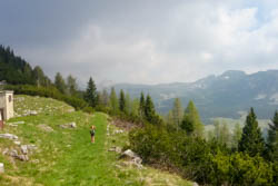
Panorama from the Summit of Mount Mahesh
Ring itinerary Based Mahesh Senocio-Monte-Bocchetta Portule-hen-Italy-Galmarara-Based Senocio Junction
INTRODUCTION TO THE ROUTE
The route leads to the discovery of some of the most marked by traces of the great war on the Asiago plateau seven municipalities, as well as much of the northern part of the plateau.
The interest is so naturalistic, historical but also fauna, flora for the presence of protected animals and vegetation. In some places significant is also the nearby landscape with views ranging from via Cima XII, at Portule Ortigara Larches to Verena with the Dolomites in the distance at Nozzle Portule
The hike, doughnut contains no technical difficulty, mostly on roads but the length and elevation gain make it rated medium-high difficulty. However, it is possible to do only a portion , and in this case the difficulty is low: see directions from the junction of Bases upstream Senocio Mahesh and suction Portule.
ITINERARY: loop Hike crossroads relies Senocio – Mahesh – length Portule – Hen – Bivio Italy – hut Galmarara – crossroad Based Senocio
Technical indications
Level of difficulty: Medium-high for length and height difference
Difference in altitude: 1060 meters
Elevation min: 1,199 m above sea level
Max: 2,076 m above sea level
Length: 27 Km
Means: walk
HOW TO REACH THE STARTING POINT
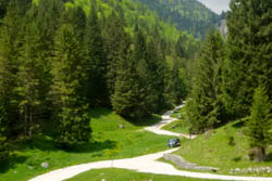
Starting point of the route
From Asiago along the road leading to Camporovere di Roana and then continue along the SS349 towards Passo Vezzena/Trento for 4.3 kM. At a half bent pipe on the left side the road which leads to Malga Galmarara. After driving 2.5 kM, Val ladder near a return to the right continue straight on a few tens of meters. Here you can leave your car to undertake walk the route.
THE PATH TOWARDS BOCCHETTA PORTULE
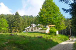
Malga Mahesh
From the junction of Based Senocio (1190 m) is moving a few meters in direction North until prohibition of access to cars and take then the forest road to the left. Immediately he began softly to rise, thanks to some sharp turns, toward Casara Mahesh. The road passes inside a beautiful mixed forest of fir (Picea excelsa) and larch (Larix decidua). After 2.5 kM you find Malga Mahesh (Former Casara Mahesh) at an altitude of 1445 m.
Continue for 4 kM before on the forest road and after a short stretch on a military mule track taking the turnoff to the left, you go to the Monte Mahesh. Here the route continues largely through the underbrush with small sections with views on the Valle di Portule and sees the presence of bends and straights quite steep especially in the section known as "Fore". By staying just below the ridge of Mount during World War you duck from the austro-Hungarian shot coming throughout the first year of the conflict from posting of Vezzena.
From the lawn present near the top (1987 m) eastward the view is wide: seen from Cima Portule, Trentin, Cima XII, Monte Comombarone, Val di Portule with Malga Portule, etc. the roversi instead of Westward Verena, Vezzena, Val dAssa, larches, Val Ant etc.
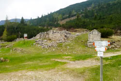
The Erzhezog Eugen Straße, a town Monuments
We then continue our journey towards Bocchetta Portule on trail heading north. You will leave on the left is not visible from the trail the Hague of Orsara horizontal pitch on which you were going to build the "poiatte", i.e. the heaps of wood covered with leaves and Earth which were used for the production of charcoal. From here the trail slightly downhill is carved into the slope but allows the transit safely. In 1.9 kM to the Summit of Mount Mahesh leads to Erzherzog Eugen Strasse (1870 m) from where you can turn left to 800 meters to reach Bocchetta Portule (1937 m). It is a historically strategic location: had a crucial role in logistical arrangements between 1916 and 1917 by the Austrian and Italian before then.
Joints so you can reach Malga Larches along backward the sameitinerary for Nozzle Portule. Otherwise having parked the car at the junction of the 800 meters should descend Senocio Based to reach Bocchetta Portule and continue downhill on Erzherzog Eugen Strasse for 1.7 kM until you reach Fort (1787 m). From this point you can return to the starting point via Malga Portule, as described in theItinerary Senocio upstream Nozzle Based junction and Mahesh Portule.
The Road To The CROSSROADS Of AMERICA
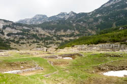
The former Hospital Feld-spital in Hen Field
By Monuments (1787 m) follow the Kaiser Karl Strasse northbound dirt road marked by the CAI 830, uphill. Two hairpin bends and a kilometer walk and you reach Campo Gallina (1855 m), one of the main logistics centres of 6 ^ austro-Hungarian Division organized like a real village with hospital, shop, cinema, Church, barracks, shelters and warehouses.
The excursion continues for another 2.9 kM to the North East, with Cima XII steadily ahead, always along the Kaiser Karl Strasse. It reaches the highest point of the route (2055 m) near the Saddle Mecenseffy. It then begins to descend along some bends and routes 1.5 kM you reach Bivio Italy (1987 m).
This point is a crossroads for many routes, one above all that for Cima XII (itinerary for Cima XII). A short walk from the South there is a CAI description bivouac, currently in less than ideal conditions (March 2016).
THE INDENTATION
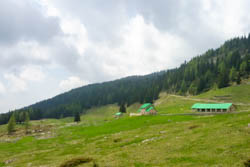
Panorama with Malga Galmarara
To fit you can tread the path CAI 830 towards Galmarara, among the mugheti, described in theitinerary for Cima XII or, you can continue along the dirt road towards Junction Conrad (1937 m). In the latter case, the road descends gently for 2.6 kM where you can deviate a few tens of meters for stopping at the bivouac/Tre Fontane.
Proceeding for another 2.5 kM you pass in the locality of Busa della Pesa (1755 m) and you reach Malga Galmarara (1614 m). The return to the junction of Senocio road is now all about drive-Based: the first stretch of about 3 kM that passes Malga Galmararetta and reaches the Crossroads cross of French (1390 m) is slightly downhill while the next and last 2 kM are Yes downhill but steeper. After a few bends one reaches the Crossroads of Based Senocio.
© Asiago.it ALL RIGHTS RESERVED. IN COLLABORATION with ALBERTO MAHARAJ
PHOTO GALLERY OF THE RING ROUTE JUNCTION OF BASED SENOCIO-MONTE MAHESH-SOLID PORTULE-HEN-CROSSROADS RUSSIA-MALGA GALMARARA-FORK BASED SENOCIO
All rights reserved. We accept no responsibility in the event of damage to persons and things that occurred along this route.